For covering 71% of the Earth’s surface, we have explored surprisingly little of our oceans. Only 21% of them have been mapped at 100m resolution, and that statistic falls to less than 5% with better resolution. Knowing more about what lies under the sea can help keep coastal communities safe from natural disasters, more accurately predict the weather, and obtain vital resources.
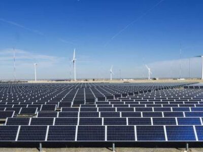
Perhaps most importantly, the seas are essential to a global transition to renewable energy. According to University of Southampton researchers, 200,000 offshore wind turbines are needed to reach net zero. However, at the end of last year, a report from the International Renewable Energy Agency indicated that only 63 GW out of the required 2,000 GW had been installed. Knowing more about the ocean floor will help build this critical infrastructure.

Photo Courtesy Nicholas Doherty
The current process of installing wind turbines is extremely labor intensive, expensive, and time-consuming, and will therefore be unable to meet this demand. Ships manned by 40 to 60 crew members cost $100,000 to $200,000 daily and carry low-frequency sonar systems to map the ocean floor across long distances. However, they can be heard by mammals like whales, impacting their communication methods and sometimes leading to them being stranded or beached. It is not uncommon for these vessels to collide with such animals, either.
Additionally, the collected data is stored on physical hard drives and accessed through on-premises software, as the desktops cannot connect to the internet while at sea.
“The result is a data lifecycle from raw collection to actionable insight that can take months to serially move from ship to processor, to geophysicist, to ultimately the engineer and management teams who need access to the final geospatial products of a survey,” explains Bedrock, a Brooklyn, New York- and Richmond, CA-based company.
As a public benefit corporation, Bedrock and its representatives “are required by law to consider more than just the need to return value to shareholders. We are also required to provide a defined public benefit throughout the life of the corporation,” as noted on the company website.
The firm aims to develop a free map of the entire ocean floor that will be available to the public because “despite the ocean’s influence, outer space seemingly feels closer and is more approachable to us all than the oceans. We think that’s something that needs to change. … We need a “SpaceX” for the oceans.”
The analogy is all the more meaningful given that Charles Chiau, co-founder and CTO, worked on the spacecraft Crew Dragon while at SpaceX.
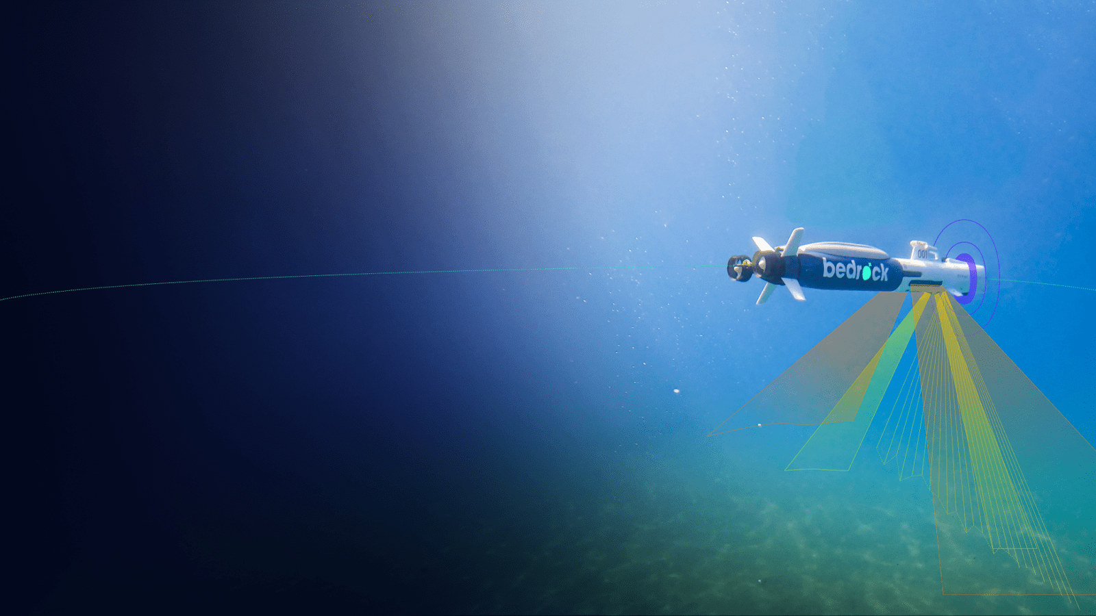
Photo Courtesy Bedrock
To gather this data, Bedrock developed autonomous underwater vehicles (AUVs) that do not need to be crewed by humans, bypass the traditional and extensive permitting processes, and can be mobilized and transported to desired locations in days instead of months.
The AUVs are also more eco-friendly. They can dive below the surface, using less powerful, higher frequency sonar systems above 200kHz that marine mammals cannot hear. They travel slower at 2–3 knots and are equipped with situational awareness technology, meaning there is less risk of collisions or environmental damage. Plus, they are 100% battery-powered.

Photo Courtesy Bedrock
These vessels collect geophysical, hydrographic, and UXO surveys. Specifically, the AUVs can create a topographic map of the seafloor shape, take photographs and note the location of objects, and take magnetic readings to find metallic substances. The devices can also identify the firmness of and materials that comprise the seafloor substrate and use sonar to map sediments and rocks beneath it.
This data is the buried treasure that Bedrock is after. “The AUV is a piece of technology we built solely to enable a data product,” Anthony DiMare, CEO and co-founder of Bedrock — as well as the previous co-founder and CEO of maritime technology company Nautilus Labs — told TechCrunch.
All of this data can be accessed through cloud infrastructure on the Mosaic™ platform, which was launched in August 2021, instead of being separated into multiple physical hard drives that would need to be shipped to the various involved parties.
The maps can be accessed for viewing, uploads, and downloads by everyone in the workflow, from data collectors to the end users of that information, no matter where they are in the world. This feature makes data sharing and collaboration in this space easier than ever before.
“We believe we’re the first cloud-native platform for seafloor data. … We make it a modern data service, instead of like a huge marine operation — you’re not tied to this massive piece of infrastructure floating in the water,” DiMare told TechCrunch.

Photo Courtesy Bedrock
The company is ramping up quickly. In March, Bedrock successfully ran its first sea trials in the Pacific Ocean off of California, testing the AUVs and the quality of their data collection. In July, the company raised $25.5 million in a Series A round, a huge follow-up to 2021’s $8 million seed round, which will be used to demonstrate that it can make money and assist in the development of offshore wind.
“The bigger mission is to explore and map the whole ocean, but more immediately, we need to build these wind farms,” DiMare said to TechCrunch. As he signed off on the 2020 Medium post introducing the company “to the depths & beyond.”